A low-pressure system over the South Andaman Sea is expected to strengthen into a cyclonic storm named Senyar over the southeast Bay of Bengal in the coming days, the India Meteorological Department (IMD) said. The storm, meaning “lion,” has been named by the UAE.
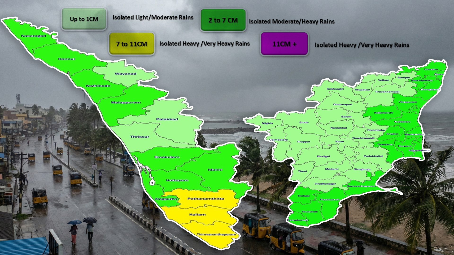
The Andaman and Nicobar Islands are expected to receive very heavy rain, with 105–204 mm of rainfall in 24 hours, along with wind gusts of up to 65 km/h between November 24 and 25. Tamil Nadu, Kerala, and Mahe are also likely to see heavy to very heavy rainfall from November 23 to 25. Other areas under rainfall alert include Lakshadweep, coastal Andhra Pradesh, Yanam, and Rayalaseema.
The IMD has issued an orange alert for Tamil Nadu, Kerala, and the islands. Residents can expect thunderstorms, lightning, and gusty winds in both coastal and inland regions. Fishermen have been advised to stay off the seas in Kerala, Lakshadweep, the Comorin region, the Gulf of Mannar, Sri Lanka’s coast, and parts of the central Bay of Bengal until November 25–28.
Several districts in Tamil Nadu, including Ramanathapuram, Kallakurichi, Thoothukudi, Mayiladuthurai, Thanjavur, Pudukottai, Trichy, Nagapattinam, Sivagangai, and Virudhunagar,have declared school holidays due to heavy rain.
While meteorologists expect the system to form over the Bay of Bengal around November 26, it is too early to predict whether it will hit the Tamil Nadu–Andhra Pradesh coast or move north toward Odisha or Bangladesh.
Authorities have urged residents to stay alert, monitor official updates, avoid venturing into rough seas, and follow safety instructions until the storm passes.
Also Read: Indian Navy commissions INS Mahe, boosting coastal defense