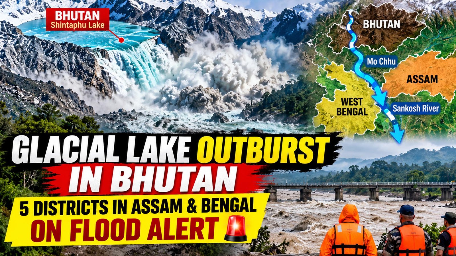
A glacial lake outburst in Bhutan has triggered flood warnings across parts of West Bengal and Assam, prompting authorities to move thousands of people away from vulnerable riverbank areas. The incident at Shintaphu Lake in Bhutan’s Gasa district on Thursday evening sent a sudden surge of water downstream, raising concerns about a possible rise in the Sankosh river and its tributaries.
The situation has kept administrations on both sides of the India-Bhutan border on alert. However, the latest updates from Indian authorities indicated that residents in the affected areas were safe after precautionary evacuation measures. The water flow was also reported to have eased slightly, although monitoring and preparedness operations continued.
Shintaphu Lake, also known as Shintaphu Tsho, is located below Wakila Mountain in the Lemthang region of Bhutan. It lies in the upper reaches of the Mo Chhu river basin and is among Bhutan’s 17 glacial lakes identified as potentially dangerous. When water from the lake is suddenly released, it flows into the Mo Chhu river and moves downstream towards the Sankosh river system.
According to reports, nearly 7.4 million cubic metres of water surged out of the breached lake. The volume raised fears of a sudden increase in river levels along the West Bengal-Assam border. The Sankosh, which originates in Bhutan and enters India, is an important river system for communities in northern West Bengal and adjoining Assam. It eventually joins the Brahmaputra.
The flood also caused damage in Bhutan. Facilities at the Gasa Tshachu natural hot springs, a popular tourist destination near the Mo Chhu river, were washed away. The area had been evacuated before the floodwaters arrived, and no deaths or injuries were reported. The full extent of the damage could not immediately be assessed because of darkness and the strong flow of water.
The flash flood also affected local infrastructure. A solar-powered irrigation project in the Punakha region was partially damaged and stopped functioning. Debris was swept onto a section of the Punakha-Gasa Highway, while reports indicated that parts of the road leading to Laya village had been washed away. The route was closed to traffic. Two portable Bailey bridges may also have been swept away, although the extent of the damage remained unclear.
The Gasa Tshachu area had suffered a similar disaster in August 2021, when the swollen Mo Chhu river changed course and flooded the hot springs. The latest incident has once again highlighted the risks faced by settlements and infrastructure located close to mountain rivers.
In India, the Union Ministry of Jal Shakti issued an advisory after receiving information about the glacial lake outburst from the Indian Embassy in Bhutan. The warning highlighted the possibility of a sudden rise in water levels in the Sankosh river, particularly in West Bengal’s Alipurduar district and Assam’s Dhubri district.
Alerts were also issued for parts of North Bengal, including the Darjeeling hills, Jalpaiguri and Cooch Behar. Residents living near the river and its connected streams were asked to move to safer places. In Alipurduar, announcements through loudspeakers were used to alert people in vulnerable settlements. Families in riverbank villages were seen leaving their homes with livestock.
West Bengal ministers and local representatives appealed to residents in the Sankosh catchment area to take the warnings seriously. People living around Kumargram, nearby tea estates and forest villages were advised to stay away from riverbanks. Residents in Tufanganj and adjoining parts of Cooch Behar were also asked to relocate as a precaution.
Disaster response teams were placed on standby, with the National Disaster Response Force and State Disaster Response Force prepared for rescue and relief operations. Teams were deployed in vulnerable locations, including Tufanganj and Boxirhat. The India Meteorological Department’s forecast of heavy rainfall in Alipurduar on Friday added to concerns that further rain could worsen local conditions.
Assam authorities also stepped up monitoring in Dhubri. The state government said it was keeping a close watch on the situation, while district officials and disaster response teams remained prepared for possible downstream effects. The Sankosh river’s water level was reported to be steady at 6.30 am on Friday, offering some relief.
Later updates from Alipurduar Superintendent of Police Amit Kumar Shaw indicated that the situation in the Indian areas was under control. He said around 4,000 to 5,000 people had been moved to shelters, while more than 6,000 others had been shifted to safer locations. Schools and other public buildings were being used as relief centres, with arrangements for food, drinking water and basic facilities.
A glacial lake outburst flood, commonly known as a GLOF, occurs when water stored in a lake formed by melting glaciers is suddenly released. The natural barrier holding the water may weaken or break, allowing a large volume of water to rush through mountain valleys. Such floods can carry rocks, soil and other debris, damaging roads, bridges, farmland and settlements.
Authorities continue to monitor river levels and coordinate with Bhutanese officials. Although the immediate flood threat in Indian areas appeared to have eased, residents in vulnerable locations have been advised to remain cautious and follow official instructions.